12 of The Best Running Tracks In Wellington
Keeping moving and getting outdoors are essential parts of staying healthy both in and out of the Covid-19 lockdown. With so many remarkable trails right in our backyards, Wellingtonians can enjoy a wealth of running routes often accompanied by jaw-droppingly stunning views, many of which will be local to your bubble. In case none of these hit the mark check here for other routes options closer to home.
With no shortage of sensational routes, lace up your running shoes and enjoy our picks for the12 best running tracks in Wellington.
Zealandia Fence Line Loop
Northland/Karori
3km north of the city just below Karori lies the Zealandia wildlife centre. To keep pests out Zealandia is surrounded by a 9km fence line which makes for an awesome running trail. To bring it to an 11.5km run, include the plush rolling additions of Highbury Fling, Sawmill, Carparts, Turbine and the zigzags from Wrights Hill to Zealandia. This is a mostly intermediate track that is well worth it for the variety of pitstops to be discovered.
The Bays
Wellington Waterfront
The route that hosts one of Wellington's most iconic running events “Round the Bays” is a great place to run in Welly. Keen runners will run the whole course from Frank Kitts Park all the way to Scorching Bay and back for a half Marathon, or parts of the course can also be taken in sections for a shorter run. Whichever section you run, the beautiful Wellington city coastline makes a stunning backdrop for a run around the bays.
Pencarrow Lighthouse
Eastbourne
The track to Pencarrow Lighthouse is a relatively easy 14.5km loop through farmland with remarkable coastal views over the Cook Straight. The trail starts from Burdan's Gate just south of Eastbourne. Encounter native seabirds and plant life thriving on the exposed coastline, along with indigenous waterfowl, eels and freshwater fish in their natural habitat at Lake Kohangatera and the adjacent Lake Kohangapiripiri. Stunning!
 Mount Victoria Loop
Mt Vic
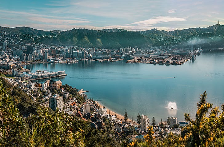
Mount Vic is probably Wellington’s most famous mount and it makes a splendid backdrop for a hill run. Just on the edge of the city centre, begin on Charles Plimmer Park on the Lookout Walkway and when you reach Pallister Road, wind your way along the road to the Mount Vic lookout where you will be rewarded with a breath-taking 360-degree view of the city.
Botanic Gardens and Tinakori Hill
Thorndon
The Botanic Garden features 62 acres of stunning gardens and bushlands and if you include Tinakori Hill this makes a really challenging and spectacular running route. Start at Midland Park and run up through the gardens whichever way you please, exiting on Glenmore Street. From here you have the option to kick it up a notch and climb up the steep Tinakori hill and reward yourself by reaching Te Ahumairangi Hill lookout with sensational views of the whole of Wellington.
Te Ahumairangi Hill
Northland & Wadestown
Te Ahumairangi Hill runs for 38 hectares through the Town Belt with Wadestown to the north and Wilton, and Northland to the west and south-west. Start at the main entrance off Orangi Kaupapa Road in Northland, and follow the well-marked ridgeline track, the northern walkway or any of the trails in between for a run with, you guessed it, dazzling views across the harbour from Miramar right over to the Hutt Valley.
 Rangituhi/Colonial Knob
Porirua
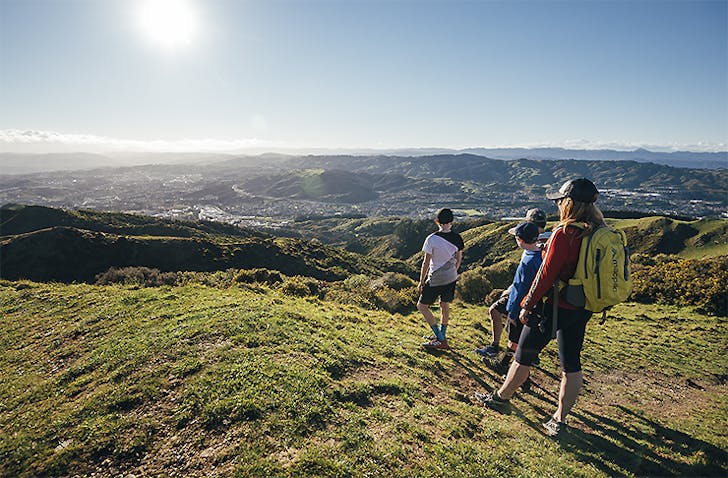
Te Ara a Rangatuhi is a large reserve on 110 hectares of farmland being regenerated into indigenous vegetation in Porirua. The reserve features a good section of trails including the Te Are Utiawu Track where you can enjoy native bush on a gentle climb to reach the Rangituhi Lookout. This trail can also connect with the Colonial Knob Walkway to form a healthy 8km loop. A great track with remarkable vistas for those who are Porirua based.
Skyline Track
Johnsonville & Karori
The 13.4km skyline track reaches from Old Coach Road in Johnsonville to Makara Saddle in Karori. The whole is a long traverse but can be completed in stages. Be aware that this is a challenging route and weather conditions can be hit and miss, but on a clear day, views of the Kaikoura ranges, the Marlborough Sounds and the Wellington city will take your breath away.
Mt Climie
Hutt Valley
The Mt Climie ridge provides the southern and eastern backdrop to Upper Hutt and a wonderful running track for Hutt residents. Start from the upper picnic area at Tunnel Gully and follow the summit with views over the valley and take in the native vegetation as it changes with altitude. A return trip clocks in at around 12kms but it is no easy feat so be prepared for some serious leg-burning climbs.
 The Hutt River Trail
Hutt Valley
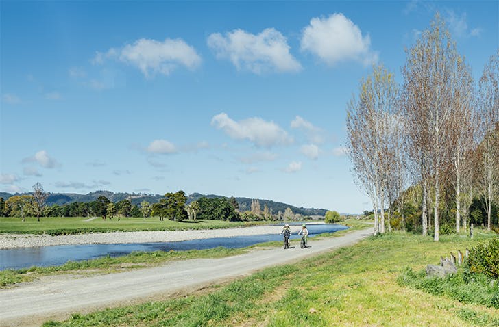
Those in the Hutt Valley can follow the picturesque Hutt River all the way from the edge of Wellington Harbour at Petone to Upper Hutt. This is a well maintained and easy route for all abilities passing through parks, golf courses, historic sites and even a couple of The Lord of the Rings filming locations. This 29km stretch can be broken up into manageable sections.
Brooklyn Wind Turbine & Polhill Reserve Loop
Aro Valley
The Polhill Reserve connects the suburbs of Aro Valley, Brooklyn and Highbury and this is one of Wellington’s number one runners' playgrounds. The loop is around 7.3km with more tracks to be added in for the challenge. Enter from either the main entrance on Aro Street, George Denton Park in Highbury or Ashton Fitchett Drive. This route is easily accessible from the city by a 20-minute walk from Civic Square up Willis Street and Aro Street. Don't forget to keep looking out to catch those harbour views.
Otari-Wilton's Bush
Wilton
Otari-Wilton's Bush is only about 5km from the city but offers a huge variety of trails through native bush including a fairly flat running trail along a stream for about 1.5km. The trails offer about 9 kilometres, with options to shorten or lengthen to your desire or ability and the top ends of the trails join onto the Skyline Track and Johnston Hill. The reserve consists of 100 hectares of native forest, including an 800-year-old rimu and around 1,200 plant species from as far away as the Kermadec Islands.
Not quite your areas? Find a path closer to home with this handy resource.
Image credit: Rangituhi / Colonial Knob and Mt Victoria by Johnny Hendrikus, Colonial Knob by Jay French, Hutt River Trail by Jay French
