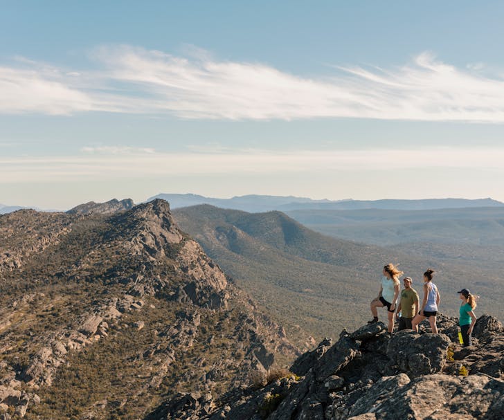
The Best Hikes In Victoria For 2023
Tongue Point Walking Trail
WILSONS PROMONTORY
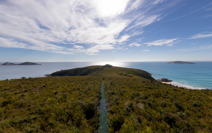
One of the best hikes at The Prom. One of the best hikes in Victoria, really. The Tongue Point Walking Trail follows the headline to the tip of Tongue Point—a lick of shrub-covered land, poking out into the Darby Bay. Giant boulders tower over your head, and you get some truly epic views of Darby Swamp, Cotters Beach and the Vereker Range.
Tongue Point is a serious hike. It’s 9.4 kilometres—one way. The whole thing should take around 4.5 hours. The landscape here is weathered coastal heath, classic Prom country. The wildlife isn’t shy either: you can often spot echidnas and wombats snuffling across the path. If you have the time, make sure you take the short detour down to Fairy Cove (you’ll thank us later).
Northern Range Circuit
LITTLE RIVER
Set out in the picturesque stretch of inland Victoria, the Northern Range Circuit is a decent hike through some of the state's most pristine bushland and terrain. Just over an hour from town, this one easily fits into the list as one of the bests hikes Victoria has on the go.
The moderate track features a steep gradient and a few sections that require rock hopping, but it's all worth it once you take in that view. If you want to change up the hike midway, there are numerous trails that allow you to create variations to shorten or lengthen the track.
O’Shannassy Aqueduct Trail
YARRA RANGES
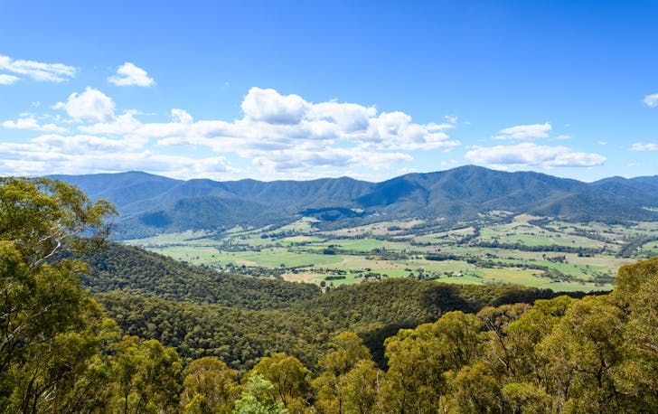
It’s time to pack your camping gear because this hike is best done over 2 days. The O’Shannassy Aqueduct Trail stretches through the Yarra Ranges National Park all the way to East Warburton which is a whopping 34.5km. On your walk, expect to see the best possible views of the upper Yarra Valley, as well as native animals including Kookaburras, Echidnas, Wallabies, and many more.
As the track is quite a long-distance, step-on-step-off areas are plotted throughout the walk as well as a rail trail at several locations to assist you in making it a shorter walk (if you wish). Take in the fern gullies, and plantations, and maybe reward yourself with a stop for a feed in the region on the way home to refuel those energy levels.
Werribee Gorge Circuit Walk
DAYLESFORD & MACEDON RANGES
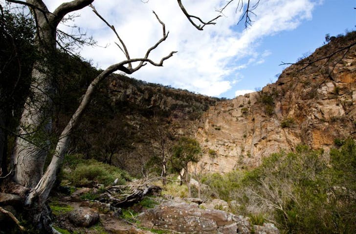
One of the weird things about Werribee Gorge is how far away from actual Werribee it is. Instead of driving down the M1, you head northwest, up towards Ballarat. In around 60 minutes, you'll arrive at Werribee Gorge State Park, a tinder-dry network of 500 million-year-old sandstone canyons.
There are a few different hiking trails inside the Gorge, and most of them link up with one another with a bit of everything. On-trail, off-trail, lookouts, descents, climbs, river crossings, cable climbs, wildlife spotting and rock hopping. The circuit hike is not for the faint-hearted. The challenging 10km circuit includes rock jumps and cable climbs. A pro tip is to start with The Quarry and hike anti-clockwise, meaning you finish on the gentler riverside track.
Pine Mountain
TINTALDRA
The hike up to Pine Mountain may be tough, but the beautiful scenic views of the surrounding Murray River Valleys are one of the key reasons why this trek is considered as one of Victoria's best hikes. Begin your hike in the car park and be sure to follow the triangle markers so you don’t get lost. Within 30 minutes of the walk you’ll hit Rocky Knob, reaching a high altitude of 640m. If you’re a shorter walker, this is the perfect time to turn back.
If not, continue the trek through the rocky pathways to reach another pitstop at Little Pine Mountain and be sure to embrace the pink granite boulders, 360 degree views, and Black Cypress plants. Here’s the perfect time to tighten those laces before the long hike that lies ahead. After another 6km, congratulate yourself for reaching the top of Pine Mountain and embrace the special atmosphere that the area has to offer.
Mason Falls Circuit
KINGLAKE
Situated in the vicinity of Kinglake lies one of the best bush hikes that Victorians can venture out to - the Mason Falls Cicuit. From an area that was devastatingly impacted by the Black Saturday bushfires, you can now walk through the 16km trail to explore aspects of the forest.
Find stunning flora, hear the sounds of Lyrebirds and try to spot wandering wallabies. It’s recommended to take a break and step out on the glorious waterfall lookout platform, where you can pause to watch water gracefully flow onto the rocks below before continuing your adventure.
Mount Bogong
TAWONGA
Located four and a half hours from the CBD is Victoria’s tallest mountain. Known as Mount Bogong, the massive 1986-metre peak is an excellent destination for one of the best hikes around. Begin your adventure in the Mountain Creek Picnic Area and make your way through to the Staircase Spur to begin the striking 16km walk to reach the summit.
Expect to be met with a steep walking track complimented by a gorgeous forest of Peppermint Gums and spectacular 360 treeless views. In winter, the area turns into a beautiful snowy wonderland for skiers to enjoy, so it's absolutely best to attempt this one during the summer months.
Mount Difficult
THE GRAMPIANS
The grand Grampians National Park is home to Mount Difficult, a key landmark located between Halls Gap and Roses Gap. Although the name sounds daunting, the track is indeed difficult yet completely and utterly rewarding. The 23.3km hike is best done over two days where you can camp in the various campgrounds nearby, though can also be conquered in a single day in around 7 hours.
The unusual rock formations, super-high terrain, and steep cliffs give hikers an excellent opportunity to embrace the picturesque landscape of the iconic Victorian region. Finish your hike with a laid-back picnic in the grounds or visit the nearby MacKenzie Falls to make the memorable hike worthwhile.
While you're out on the road check out:
The Best Beaches In Victoria
The Best Camping In Victoria
The Best Free Camping In Victoria
The Best Glamping In Victoria
Image credit: Visit Victoria, Parks Victoria

